Beth Marley grew up in the St. Andrew's area and her grandfather was an Ontario Land Surveyor whose work included this area. As a result, Beth has provided us with some wonderful memories and photographs.
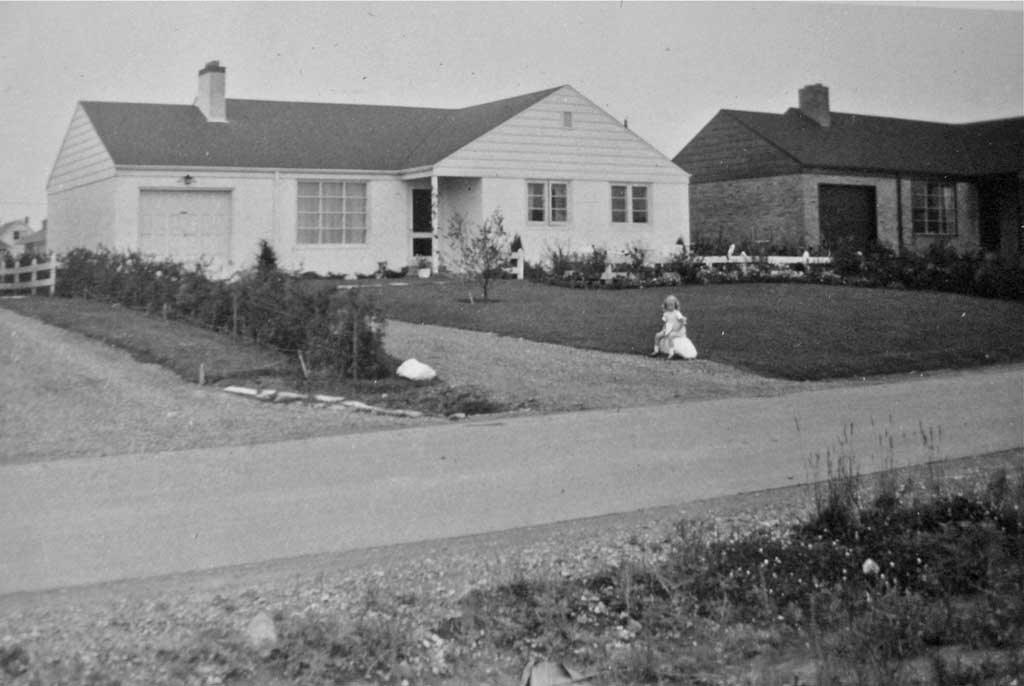
This is Beth Marley (Howard) in front of her childhood home at 12 Fairmeadow Avenue, in July 1951. She writes:
My parents bought a bungalow on Fairmeadow Avenue in 1950; I was three and the houses in “Yorkminster subdivision” were under construction, so there were piles of dirt everywhere. The field across the street (that became the Fairmeadow P.S. playground) was a mass of wildflowers and weeds... including poison ivy, as I discovered to my grief. There were no phones installed for a while so if my mother wanted to call someone, we had to walk to the corner of Fairmeadow Avneue and Upper Canada Drive to use the pay phone.
Our living room window was big, as was the dining room window; neither opened. Facing east/west with no air conditioning in those days, and no big trees made for a hot house in the summer, so my parents soon had awnings installed on all the windows front and back (as did many others). Ours were green, from Eatons. The house to the right in the photo (number 14) belonged to Byng Whitaker (of CBC), host of The Small Types Club (children’s radio program at noon in the ‘50s).
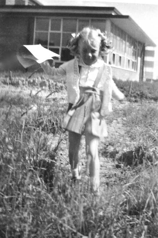
This is Beth Marley after her first day of school at Fairmeadow public school on September 4, 1951, she writes:
Fairmeadow P.S. opened in September 1951 but wasn't ready for kindergarten registration that summer, so one morning the mothers and children walked across the dirt road that would become Highway 401, to register at Avondale P.S. for Fairmeadow P.S. At Fairmeadow P.S., while the schoolyard was all around the school, girls were to play on the north side, and boys on the south side – and the hill on the east side was forbidden in spring when it was muddy. A few years later, the parents association raised the funds for playground equipment (swings, slide, teeter-totter) which was installed just south of the school, this equipment was moved to Tournament Park when Fairmeadow P.S. was closed as a public school in 1981.
York Mills Plaza (shopping centre) was built in 1952 or 1953 – a godsend for the area. It was originally just one strip, between a Royal bank at the east end (where Japan Camera was until recently) and the Dominion store. In between were Koffler's Drugs (Murray Koffler was the pharmacist, this was his first pharmacy and from this he founded Shopppers Drug Mart), Hunt's bakery, a hardware store, a clothing store and I forget what else… possibly a barber or hairdresser. My mother was loyal to Loblaws so she shopped for groceries on Yonge Street (there was a Loblaws and a Kresge on the east side of Yonge Street north of Sheppard Avenue, around Spring Garden Avenue or Hollywood Avenue). Dempsey's hardware (which was on the north-west corner of Yonge Street and Sheppard Avenue) with its wooden floors on several levels was packed with all sorts of stuff. But Hunt's bakery, Koffler's and the hardware at York Mills Plaza were the stand-bys.
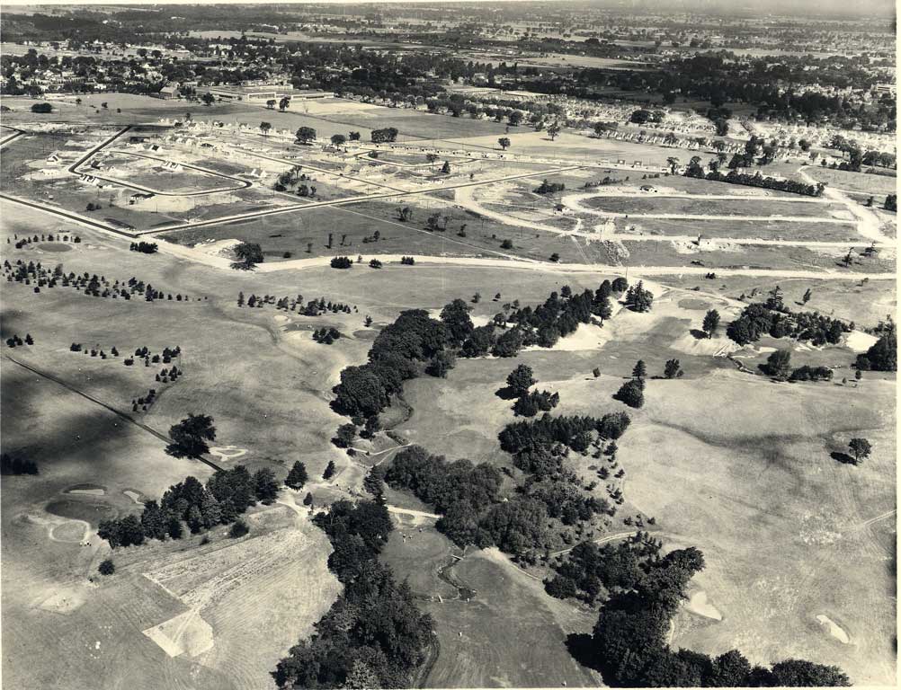
This is an awesome aerial view, taken over St. Andrew's Golf Course in June 1949. The view is looking north-west (a higher-resolution image is here, and zoomed-in views are towards the bottom of this page). At the top-left is the loop of Aldershot Crescent, to the south of it (left) is Lord Seaton Road which here only extends east as far as Fairmeadow Avenue (to the right of the loop). Note that Wilket Creek is still a creek, there are bridges for the golfers to get over it.
Beth reports the photograph ...
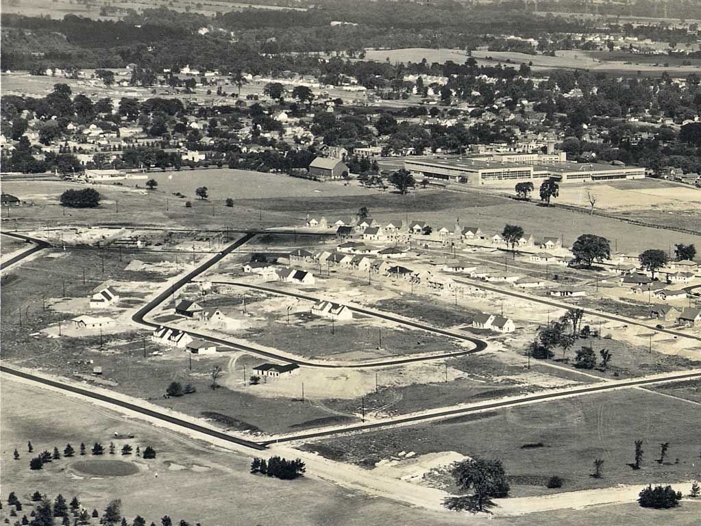
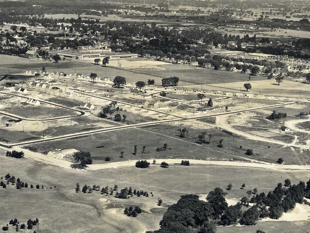
Is taken looking north-west from about where Knollwood is now. The streets in Yorkminster subdivision are laid out and the hydro poles installed. Some of the houses are built or under construction, mostly on Upper Canada Drive. Beyond, on Yonge Street you can see the new Maclean-Hunter printing plant, which was built in 1947 to 1948).
Our subdivision was entirely isolated, with only one way in and out at the north-west corner at Lord Seaton Road and Upper Canada Drive. We were shut off on the south and east by the golf course, and on the north by the highway. That meant almost no traffic: residents, a few visitors, and delivery trucks (Eatons, Simpsons, bread man, milkman). Our spaniel used to lie in the middle of Fairmeadow Avenue waiting for my mother to come home from shopping. If someone happened to come along, they just drove around her. We rode our bikes everywhere in the middle of the road, without ever thinking about cars.
Following Fairmeadow Avenue north we can see houses are built on the north side of Upper Canada Drive, and to the north of those houses is just field, Highway 401 has not yet built north of those houses. To the right we see the loop of Cotswold Crescent ends at Lord Seaton Road, which continues north of Upper Canada Drive (where Lord Seaton Park is now, just south of Highway 401) and becomes a path that crosses what is now Highway 401, and goes to Avondale Avenue. A current map of this area is here).
Beth continues:
The golf course was forbidden territory for we children, so naturally we tried to play in the sand traps as much as possible, especially in winter when they made great bases for snow forts. The line of pines down the fairway (dark dots in the 1940 photo) was another favourite place to explore. We called it “rabbit run.” With its hills, big trees and valley, the golf course was a great place to run wild with imagination. One summer we got into trouble for going into the clubhouse to buy ice cream. I remember the clubhouse as facing Old Yonge Street. It was white clapboard, I think, with a verandah or porch.
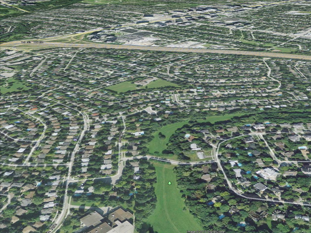
This is a Google Earth image of the same view as the above photograph. The streets in both include Aldershot Crescent, Fairmeadow Avenue, Lord Seaton Road, and the early development of Cotswold Crescent and Yorkminster Road.
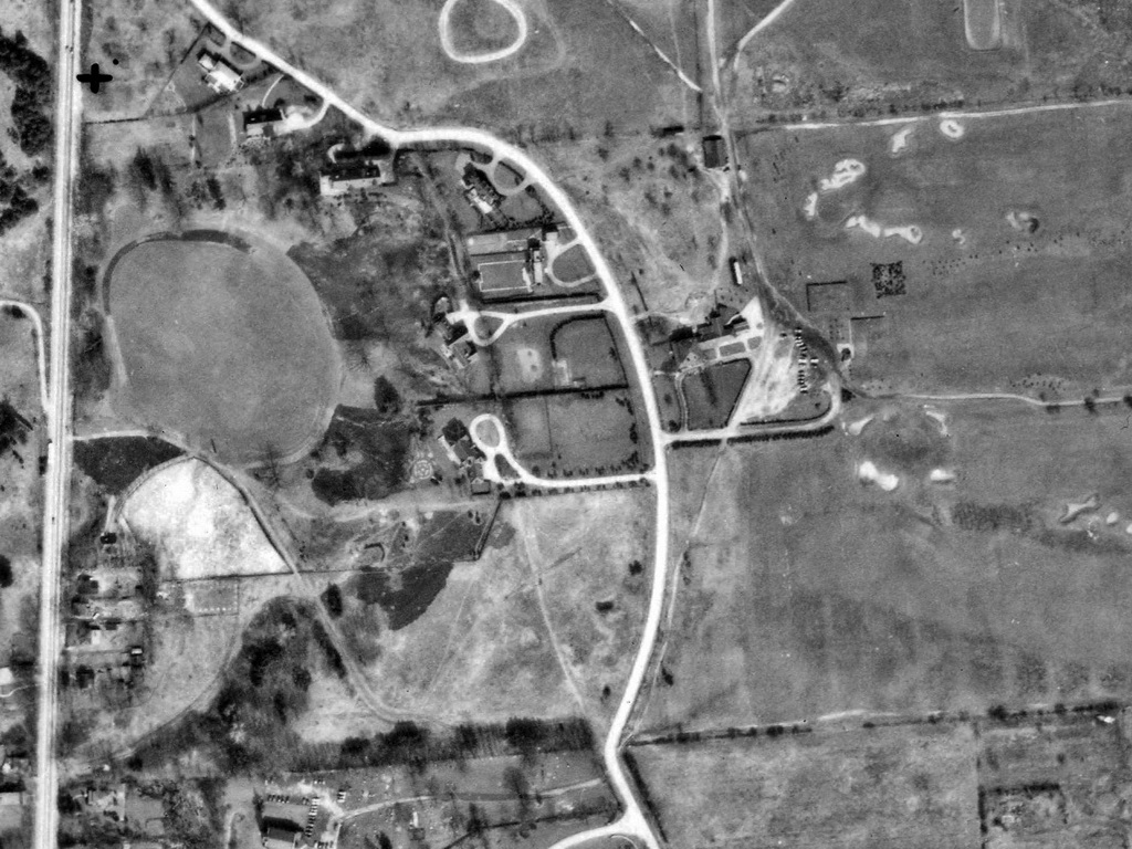
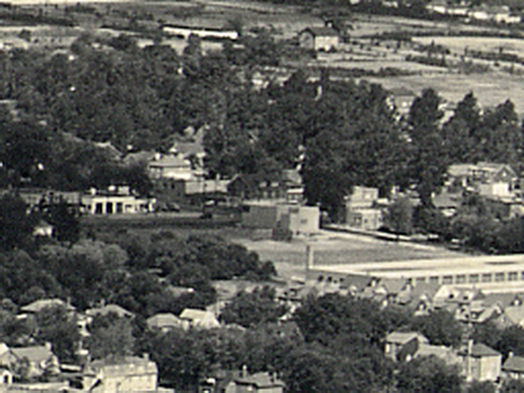
The above photograph is described here, and it shows the west end of the golf course. Yonge Street is at the left, and St. John's Anglican Church is at the bottom, with the curved road through the cemetery to Old Yonge Street (what is now the church parking lot and driveway are here farmland). The big curved road in the centre of the photograph is Old Yonge Street (here we can see that it used to continue to Yonge Street – there is no Upper Canada Drive up to Lord Seaton Road). The south boundary of the golf course is what is now the backyards of the houses on the south side of Lower Links Road, and the north boundary is what is now Lord Seaton Road. The golf course's parking lot and clubhouse were near the entrance driveway to the golf course, which was what is now the west end of The Links Road where it meets Old Yonge Street (which curves around the top of the valley).
According to Patricia Hart's book Pioneering in North York, Augustus Jones laid out Yonge Street in 1794, but it was found that Yonge Street could not be built continuously around York Mills, as the land at the bottom was too swampy, and the hills too steep, so what is now called Old Yonge Street was used to avoid this and to cross the Don River where it was easier.
Beth continues:
Across Old Yonge Street from the clubhouse were several very large homes set way back from the road. In the 1940 photo you can see the long driveways ending in a circle by the front doors. One of them was the home of Cardinal McGuigan.
Old Yonge Street curves north-west to where it used to connect to Yonge Street, and where Lord Seaton Road comes out now. Old Yonge Street was laid out that way to avoid the steep hill on Yonge Street north from York Mills Road – almost impassible for horses pulling wagons and coaches in mud or snow. So they would leave Yonge Street at the York Mills Hotel [Jolly Miller], go east along what is now Mill Street, and make their way north along the ridge (which is now called Old Yonge Street).
Yonge Boulevard was laid out for the same reason – to avoid the steep hills. Even early automobiles would have had a problem with those hills. My grandfather said he had to back his car up steep hills.
Along where Old Yonge Street now ends in a dead end at the Yorkminster church parking lot were large homes on the west side, backing onto the valley.
When St. Andrew's golf course was being developed (around 1960?), the model homes were on the south side of Lord Seaton Rd., at the bottom of Fairmeadow. They always seemed to be open and unattended because I remember going through them several times with my friends (we were 12; it was an adventure).
Hard to believe so much has changed in just 60 years.
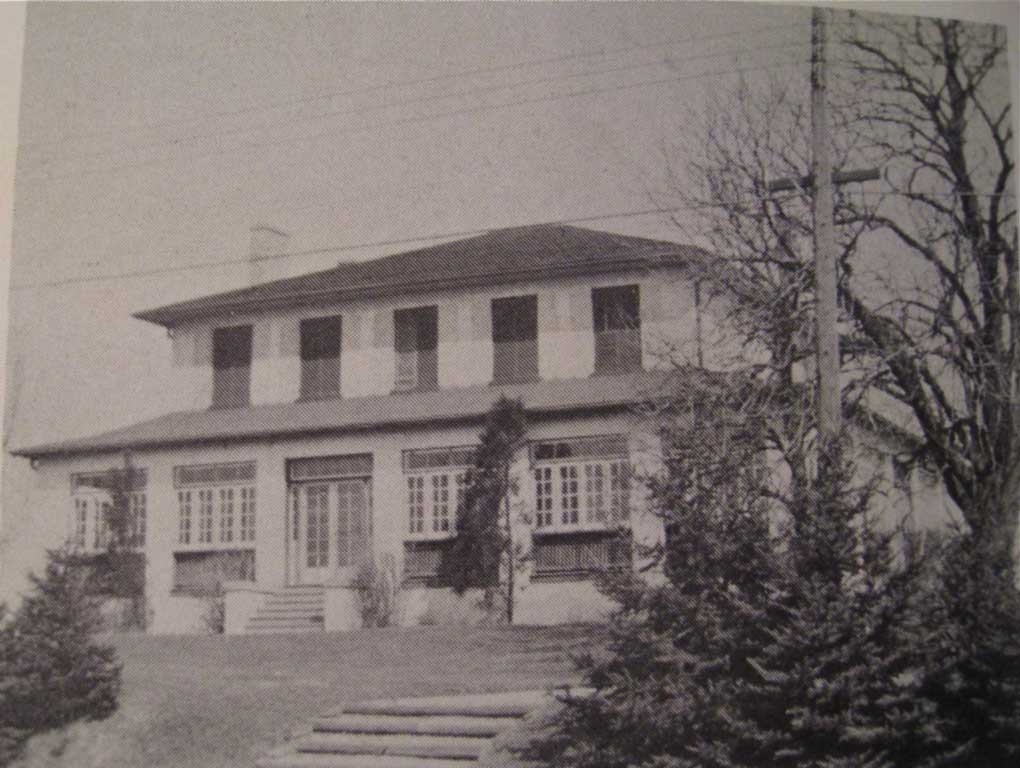
Beth initially found this web site "while looking for a photo of the St. Andrews Golf Course clubhouse". As shown above, she found this in the book Pioneering in North York, by Patricia Hart. Beth reports:
The house was built in 1835 by Lt.-Col. Duncan Cameron, C.B. I was right in remembering it as white, but I think it must have been stucco (on brick). The clubhouse was called Lyndally, after his family home in Scotland.
Beth compiled some history of the St. Andrew's area, available here.
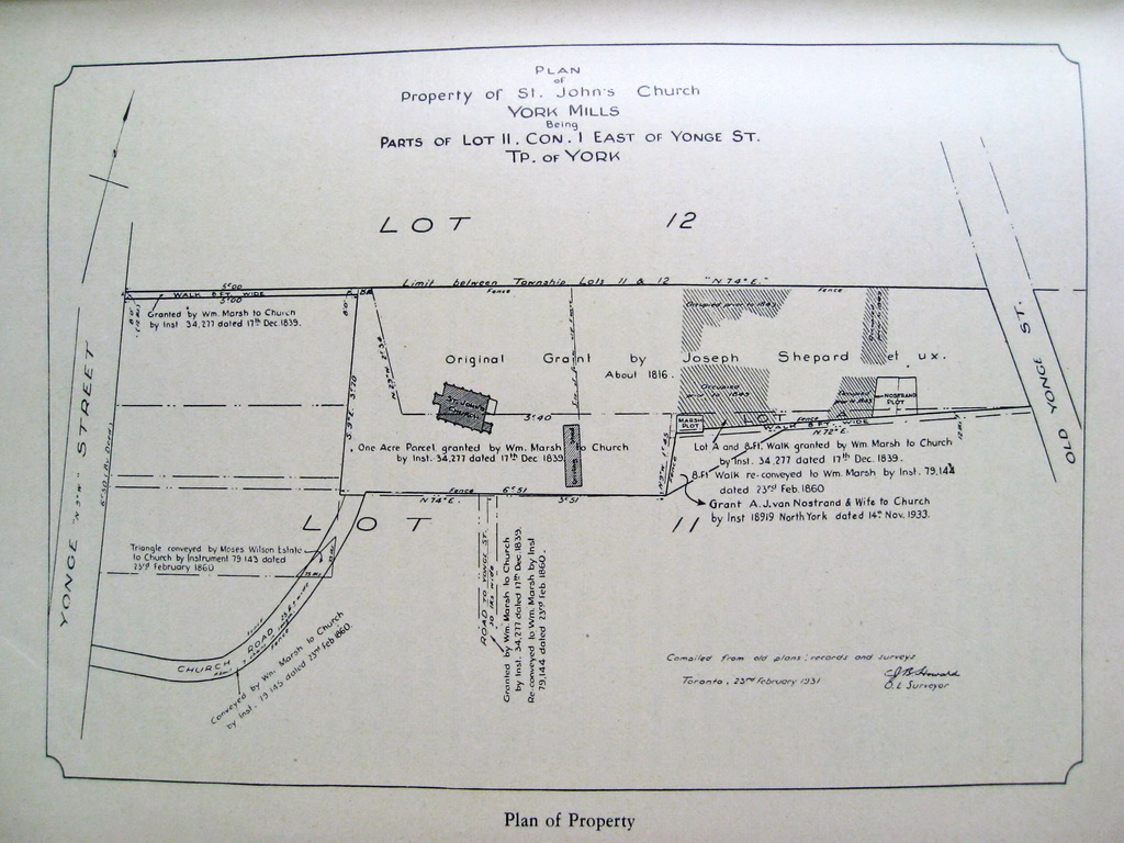
Beth's grandfather, C.J.B. Howard was an Ontario Land Surveyor, and created this "Plan of Property of St. John's Church, York Mills, Being Parts of Lot 11, Concession 1, East of Yonge Street, Township of York", dated February 23, 1931. A higher-resolution image is here
The drawing is quite complex, showing the many land grants adjacent landowners made to the church, along with the associated instrument numbers and the dates of these grants.
The main sanctuary of the current church, as shown in this drawing, was completed about 1844.
The text in the long narrow building to the east of the church says "Driving Shed". This is what we would now call a garage – though unlike your typical modern one- or two-car garage, a driving shed would typically be narrower and longer, and not be attached to a house or barn. A driving shed would be an unheated wood or metal building in which one would park (and perhaps repair) all things in which one can go driving – carriages, wagons, and automobiles, and also keep spare parts for them. This building was removed sometime before the aerial photograph below, which was taken in 1940.
As shown in the historical drawing above, Wm. Marsh granted three paths to the church on December 17, 1839:
At the base of the Church road is the C.W. Jeffreys house, an article about it is here.
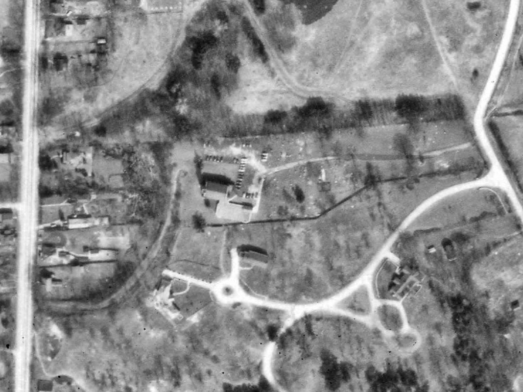
This aerial photograph from 1940 shows that the parish hall and Sunday school wing has been added to the south of the main church building. The curving path through the cemetery to Old Yonge Street can be seen, as can the low stone fence to the south of that along Old Yonge Street at the entrance to York Ridge Road.
Note the path directly to the south of the south of the church. This would have been the grant above that was later exchanged for the Church Road, presumably it continued to be used by some.
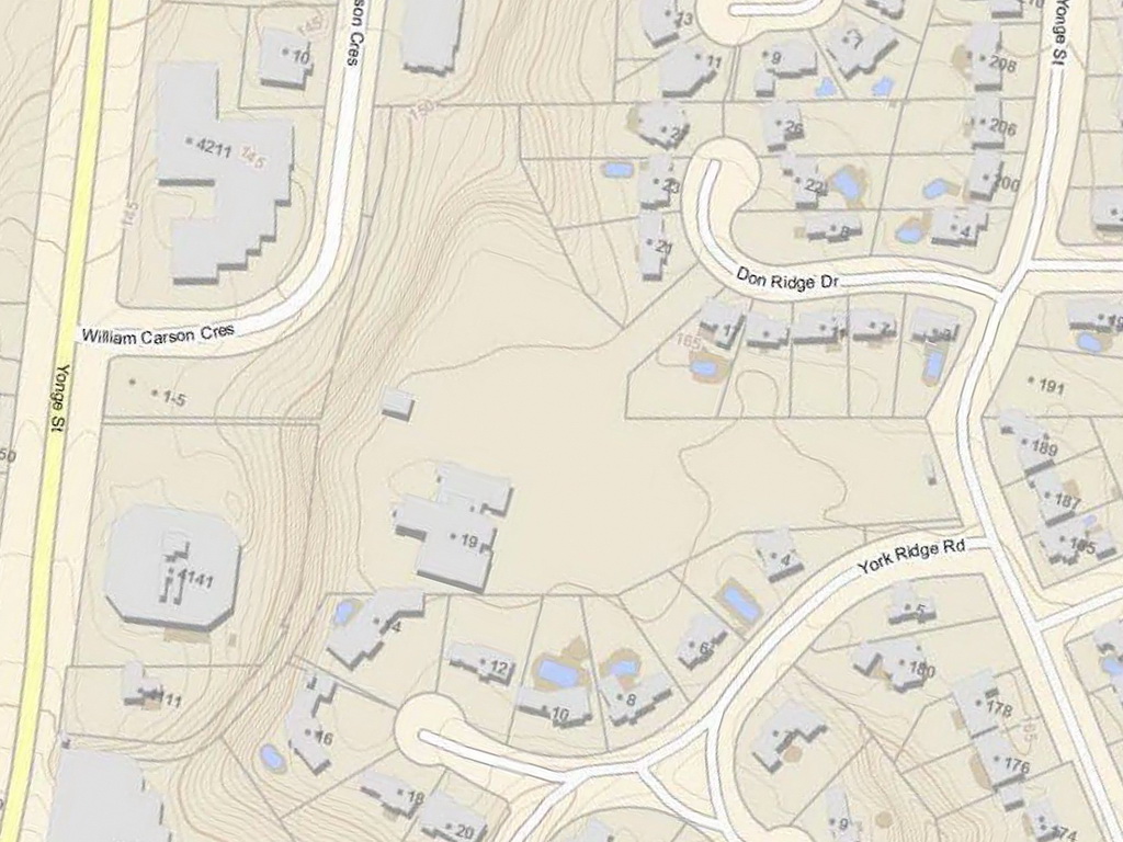
As a comparison to the above historical drawing, here is a map showing the current property lines and building outlines for the same area.
Superimposing this on the historical drawing above shows that the current "church path" follows the historical Church Road, except at Yonge Street, where the historical Church Road is shown to meet Yonge Street about 25' farther north than the current path.
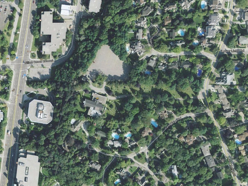
And as a last comparison, here is the Google Earth satellite image of the same area.
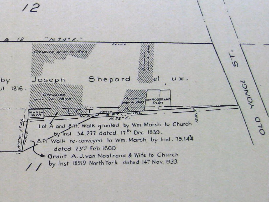
Here is the right side of the historical drawing, showing that as we see today, the cemetery has large family plots for Marsh and van Nostrand. As shown on this drawing, Wm. Marsh granted several parcels of land to the church, as did A.J. van Nostrand (who is shown on this map to own land approximately where Lord Seaton Road is currently).
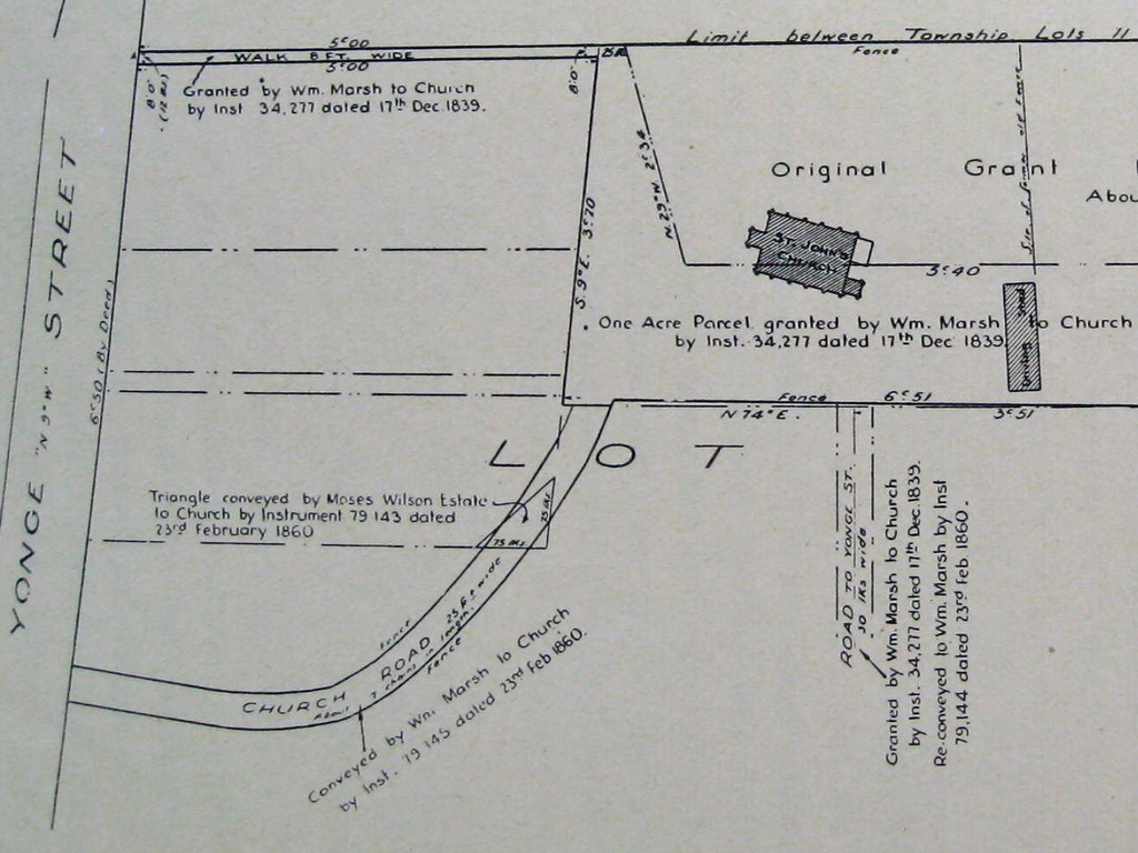
The left side of the historical drawing shows the "church path" down to Yonge Street. The drawing notes this was "Conveyed by Wm. Marsh to Church by Instrument 79 145 dated 23rd Feb 1860." and that the "Church Road" is 25 feet wide and "About 7 chains in length." A chain was a unit of measurement common in surveying, and is equal to 66 feet, so a length of 7 chains would be (66 x 7 =) 462'.
A very common Crown land grant and Lot size was 100 acres, which is exactly 20 chains by 50 chains (1,320' x 3,300'). A smaller unit of measurement is the link, and there are 100 links in a chain.
The drawing notes that there was a fence along both sides of the Church Road, and that the curve of the path traversed the south-east corner of the property of the Moses Wilson Estate, and this triangle of land was also conveyed to the Church on February 23, 1860. The dimensions of the right-angle triangle are shown to be 75 links (abbreviated "lks") x 75 links (which is 49.5' x 49'5').
Beth found this photograph at the Toronto Public Libary who note it was probably taken in 1937. Shown is a partially-open gate across the Church Road leading up to St. John's Anglican Church, York Mills. Note that the main path seems to go to the left, while a narrower path goes up the steeper section more directly to the church. Note also that the 1940 aerial photograph above also seems to show a path along the top edge of the valley leading more directly to the church. This gate is likely part of the fence between the Moses Wilson and Wm. Marsh properties (that is, the "triangle" of land later conveyed to the church is likely on the far side of this gate).
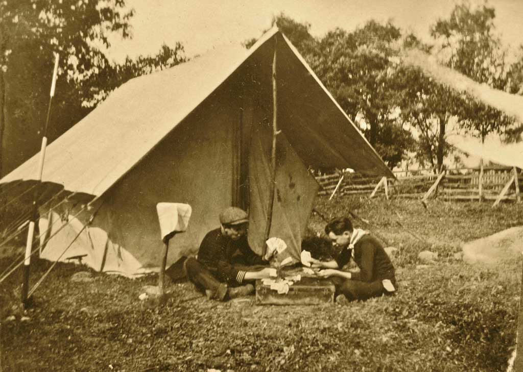
Beth reports that her grandfather C.J.B. Howard took this photograph in October 1914 while he was part of a party surveying the York Mills area. The surveying was being done by Speight & Van Nostrand Ltd., which was incorporated by Thomas Bailey Speight and Col. Arthur J. Van Nostrand in 1905 (presumably the latter is same person as granted land to the church). This company, as Speight, Van Nostrand & Gibson Ltd., is still operating today (they may have a web site at http://www.svng.on.ca). These surveyors seem to be using the top of a suitcase on which to play a game of cards. T.B. Speight and A.J. Van Nostrand are included in the monument honouring Ontario's early land surveyors, which is opposite the Loblaws at the top of the Yonge Street hill south of York Mills Road.
Here is the top-left part of the June 1949 aerial photograph, you can see:
This is the top-centre section of the June 1949 aerial photograph, in which we can see:
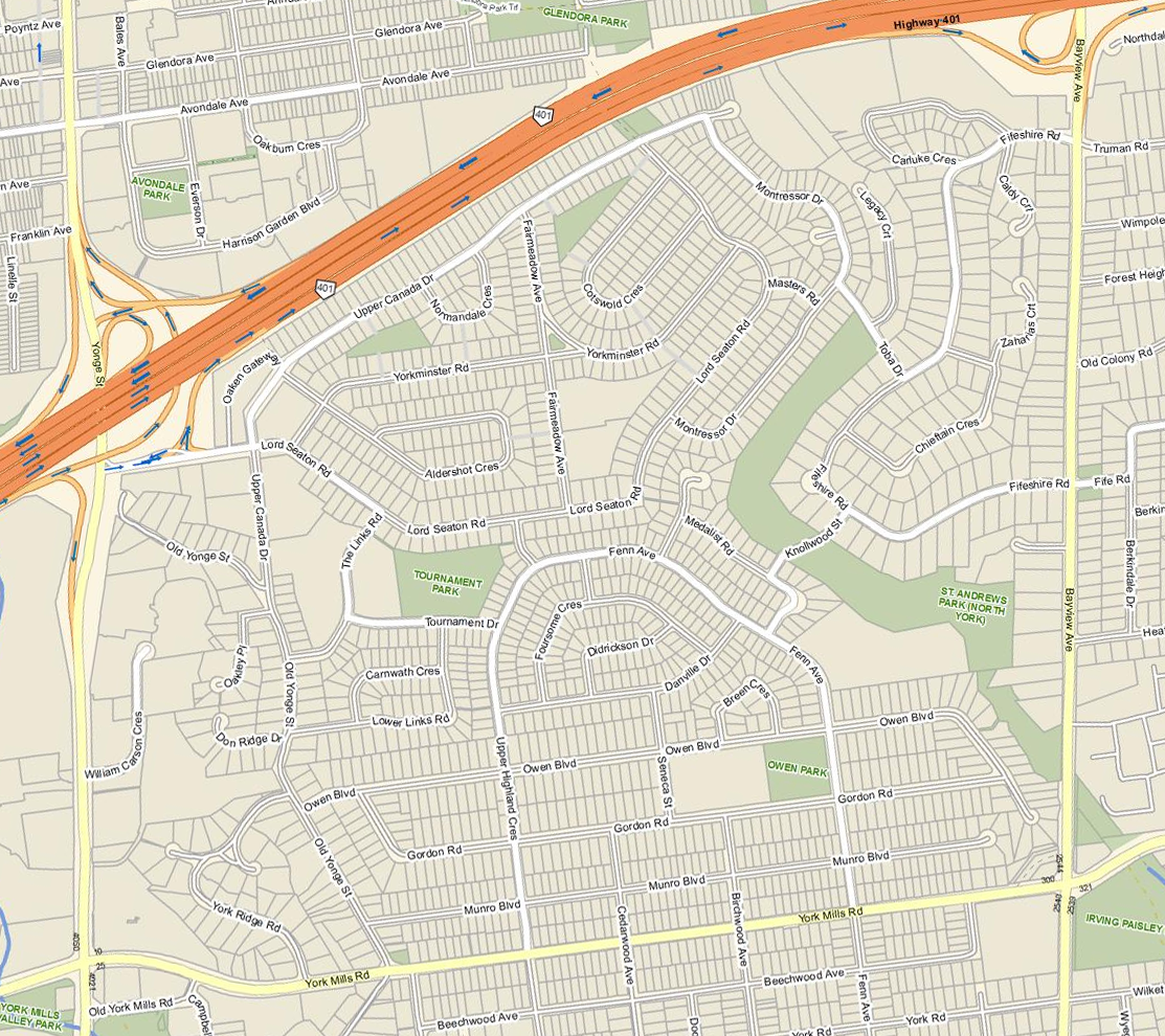
Here is a current map of our area.
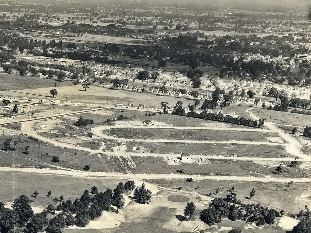
Here is the top-right section of the June 1949 aerial photograph, in which we can see:
Here is a zoomed-in view of the intersection of Yonge Street and Sheppard Avenue, on the north-east corner you can see a building with two dormer windows across the roof (facing east), this is the Dempsey Brothers Store (to the left of it, on the south side of Sheppard Avenue, is a white building with three large doors, likely a garage / gas station). The Dempsey Brothers building was moved 1 km north-west in 1996 and the dormer windows have since been removed.
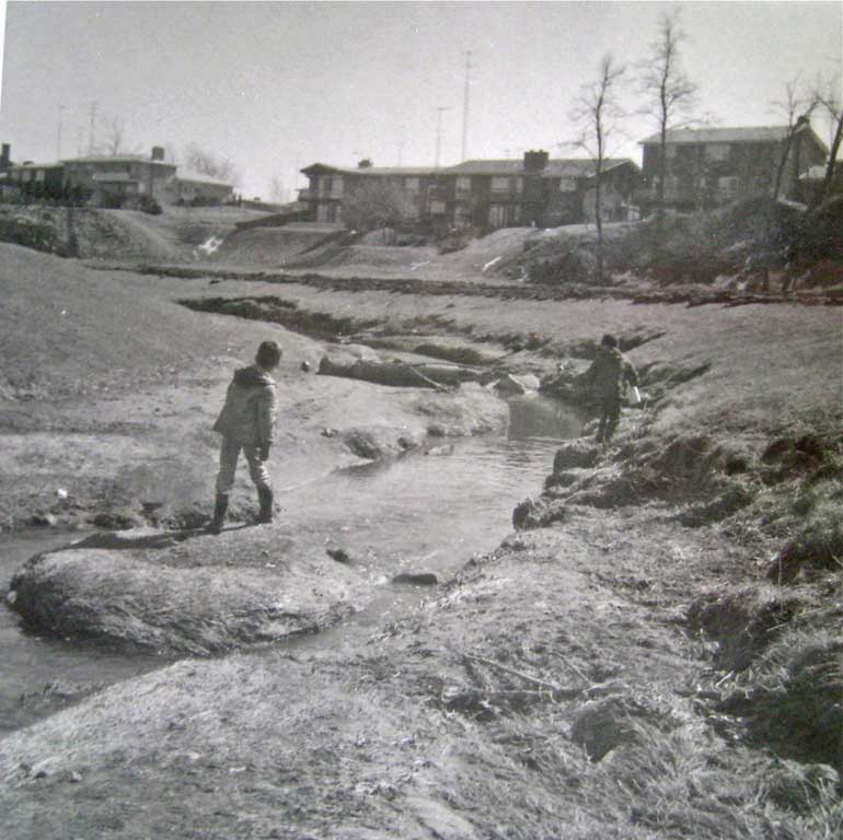
This photograph was taken by Beth in 1968 and shows the valley behind the houses on the east of Montressor Drive and Medalist Road. The golf course is gone and the area developed, note the many television antenna towers. The view is looking south, and Knollwood Street is at the top of the "toboggan hill" at the left of the photograph. Those same houses on Medalist Road on either side of Knollwood Street are still there today.
This section of Wilket Creek is what is shown in the foreground of the June 1949 aerial photograph above. It appears there is a long straight row of dirt above the bend in the creek and this may be the trenching to install the pipe that now carries that water.