Some History of the St. Andrew's Area
Historical Photographs from the City of Toronto archives
This aerial photograph is from 1947 (click for a higher-resolution image, press Ctrl "+" to zoom in), and we can see:
- Highland Crescent at the bottom, and Upper Highland running up near the west side, Seneca Street is to the right of that.
- Above Highland Crescent is Beechwood Avenue (to Doon Road) and above that York Mills Road.
- But Munro Boulevard is not yet built, and the Gordon Road and Owen Boulevard are built as shown on the Plan of Subdivision, but there are no houses built there yet.
- The St. Andrew's Golf Course (fairways and sand traps can be seen) is north of Owen Boulevard, and Lower Links Road has not been built yet.
- The angled path from the bottom-right to the top-left would have been the most direct route to Yonge Street north of the valley, coming from anywhere south and east of the valley.
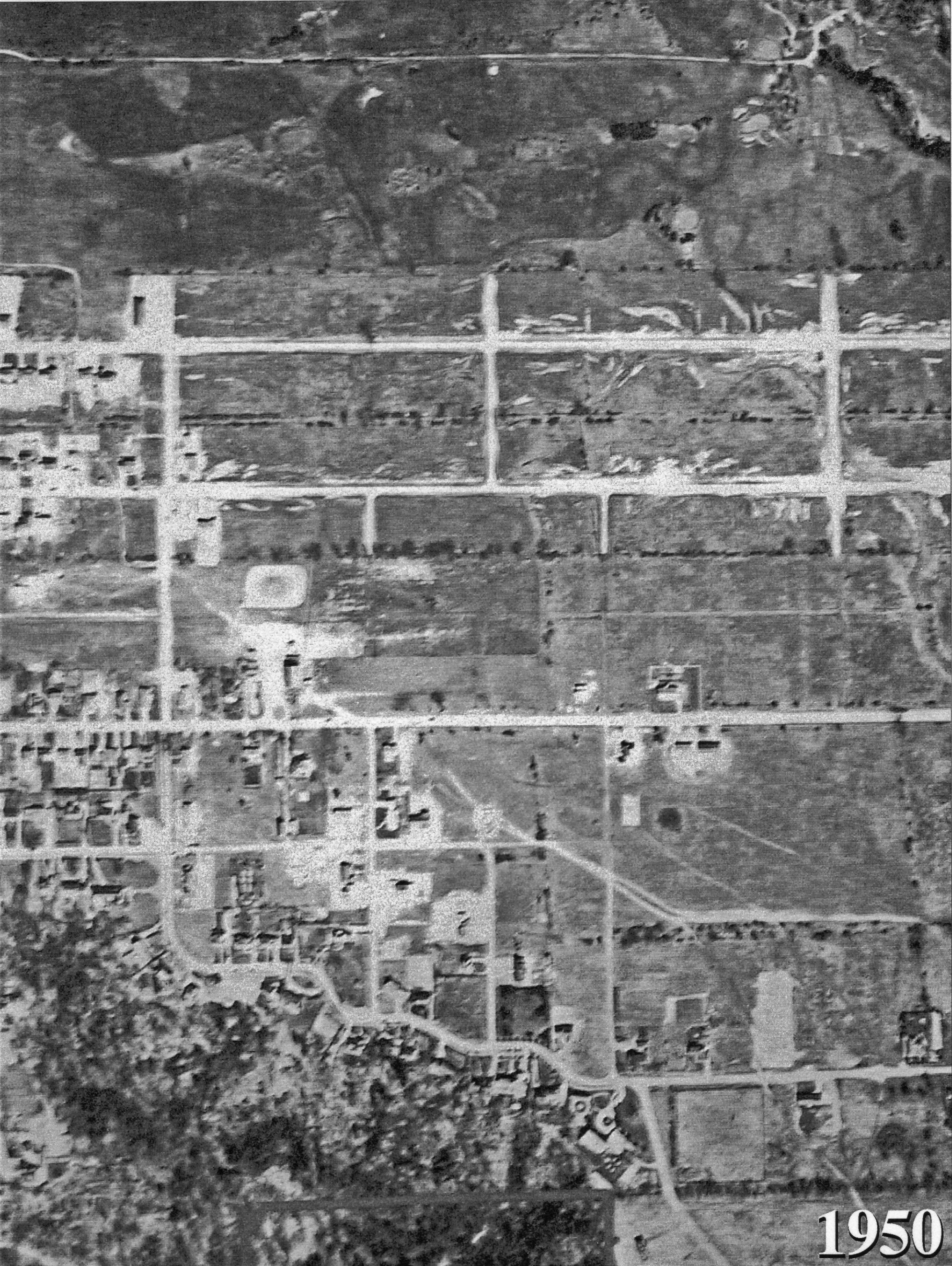
This aerial photograph is from 1950 and extends farther to the east, to include Fenn Avenue (which does not yet extend as far south as York Mills Road):
- Compared to the 1947 photograph above, we can see that west of Upper Highland Crescent, houses have been built on Gordon Road and Owen Boulevard.
- Upper Highland Crescent now connects to York Mills Road.
- Also, there is more built along York Mills Road.
This aerial photograph is from 1953:
- There has been substantial development. Munro Boulevard has now been built west of Upper Highland Crescent, and there are houses there as well. Cedarwood Avenue now extends up to Gordon Road.
- West of Seneca Street, there are many houses built along Gordon Road and Owen Boulevard.
- There seems to be a long double row of trees between Gordon Road and Owen Boulevard (these are in the 1947 photograph as well), perhaps this is the reason for the linear park which had been proposed there.
- House have been built all along the south side of York Mills Road, and along most of the north side as well.
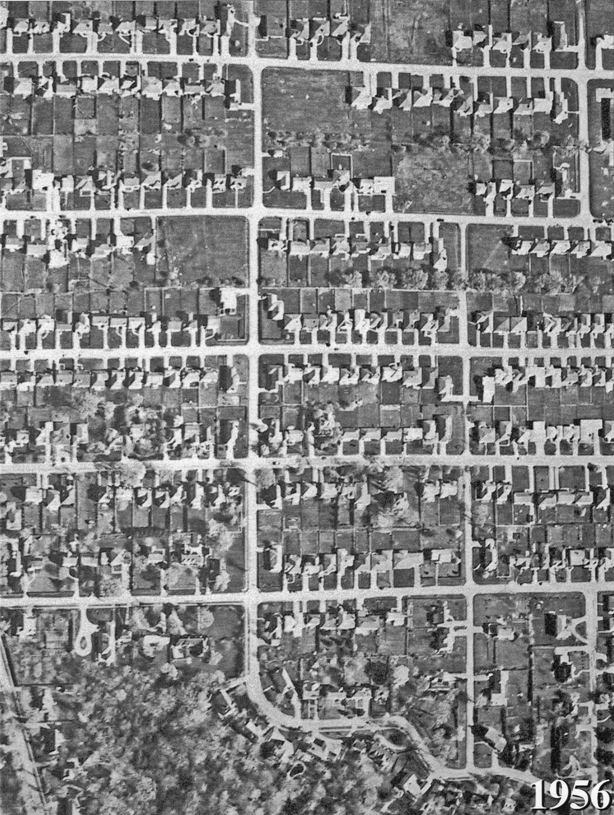
This aerial photograph is from 1956:
- This image does not include the St. Andrew's Golf Club at the top, but shows that Munro Boulevard has now been built east of Upper Highland Crescent, and houses have been built on almost every lot available.
- Seneca Street is at the right of the photograph, near the top, and to the right of that appears to be the original Owen Public School.